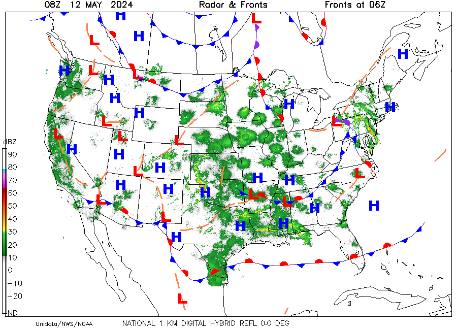
Radar & Fronts
Map showing color-coded values of radar return intensities (reflectivities)
from a national network of radar sites along with positions of fronts and
centers of major weather systems. Radar data are for time shown in upper left
margin while front position time is shown in upper right margin.
Frontal types and positions are provided every three hours (00Z, 03Z, 06Z,
etc.). For examples, see "Weather Map Symbols" from the Extras
section of the homepage.
Symbols for Front Type:
- Blue with triangles --- cold front.
- Red with semi-circles --- warm front.
- Purple with alternating triangles and semi-circles on the same side of line
--- occluded front.
- Alternating red semi-circles and blue triangles on opposite sides of line
--- stationary front.
- Dashed orange --- trough or extended area of low pressure.
- Dashed red with double dots --- squall line of intense thunderstorm
activity.
- H --- local center of pressure higher than surrounding stations,
with central value in millibars.
- L --- local center of pressure lower than surrounding stations, with
central value in millibars.
